

Mount Gabriel [Cnoc Osta]
Good walks are even better shared.
V9334 : Air traffic control
Richard Webb Photo source
Overview
Mount Gabriel [Cnoc Osta]
Mount Gabriel, or Cnoc Osta, rises proudly at 705 meters within the Shehy Mountains of County Cork. It’s a prominent Marilyn, offering a worthwhile challenge for hikers and those simply looking to enjoy the peaceful embrace of nature.
Geology
The mountain's bedrock is essentially Old Red Sandstone, a captivating reminder of its volcanic past. Expect to see striking red hues punctuating the landscape where the shales and sandstones meet, along with interesting forms and textures that bring geological history to life.
Routes
One of the most popular routes is The Glenmullyn Loop, a moderate circuit that covers about 8.5 km. This route gives walkers a good mix of lowland beauty and hilltop views. It all starts in the quaint Glenmullyn, making its way through lush pastures and gently rising slopes before reaching the summit. Make sure to pack your sense of humour and some snacks—you're gonna need both!
Summit Features
At the summit, you'll find a commanding trig point and a sturdy stone cairn. The views will leave you gasping—arms raised as if trying to grasp the horizon! Capture the stunning landscapes that stretch far below. But hold onto your belongings tight, as the winds might be a trickier adversary than your hiking partner!
Terrain Type
The terrain can be characterised as a delightful mix of grassy expanses peppered with rocky outcrops. You’ll find it’s just rocky enough to keep things interesting without needing climbing gear. Good footwear is essential as the path can become slippery post-rain!
Views
The summit rewards hikers with spectacular views including the Macgillycuddy Reeks and shimmering Lough Hyne to your east. Ideal seasons for these breathtaking sights are spring and early autumn, when the weather is pleasant and the landscape vibrant in colour.
Hazards
A note on safety: weather can change faster than a sheep can baaa! Prepare for sudden fogs and rain—set your sights on clear days for the best hiking experience.
Nearby Summits
If you're feeling adventurous, the nearby Knockakilla offers another taste of the heights with its 470 meters to conquer. A nice one to keep your legs warm!
Access
Parking can be found in Crookstown, and don’t forget your trusty walking boots—it’s just a short jaunt to the base trail from the village. Skibbereen is a nearby town buzzing with life, making it the perfect place to refuel after a day on the hills.
Facilities
Although there are no facilities at the summit, Skibbereen provides a feast for the senses with cafes aplenty. Ensure those weary feet find rest while enjoying a cup of tea or a hearty meal post-hike!
History
The name ‘Cnoc Osta’ sheds light on the spiritual echoes lingering around this ancient hill. Attracting hermits and wanderers alike, it's a place steeped in local lore.
In summary, a hike up Mount Gabriel offers not just a physical challenge but a journey through history and nature's grandeur. So lace up those boots, grab your walking stick, and make some memories!
Explore routes near Mount Gabriel [Cnoc Osta]
Walks starting near this hill. Open a route to check its map, distance and full itinerary.
Route planning notes
These notes describe possible approaches. Check a route's map and access information when planning your walk.
The Glenmullyn Loop
A captivating circuit that begins in the tranquil Glenmullyn, winding through lush green pastures before ascending the slopes of Mount Gabriel. Ideal for those looking to get lost in nature, but not too lost.
Make a day of it, together
Find someone to share the walk with, or organise a day out along a route you like.
Photo Gallery
View all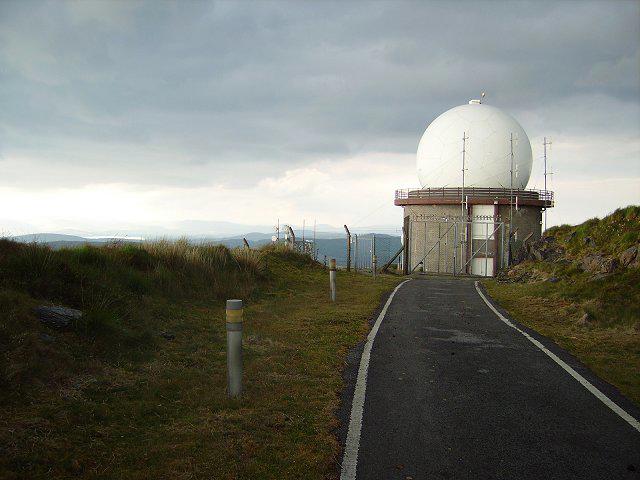 Photo could not load
V9334 : Air traffic control
Richard Webb
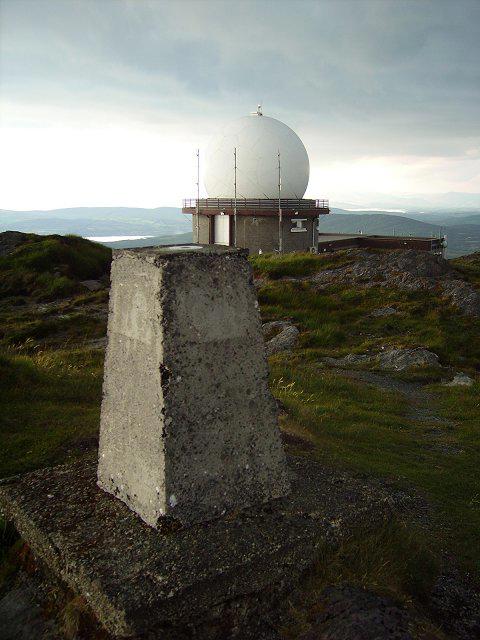 Photo could not load
V9334 : Mount Gabriel
Richard Webb
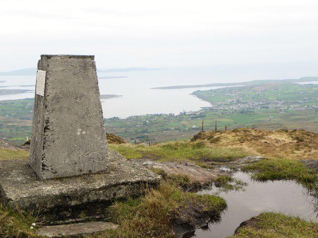 Photo could not load
V9334 : Mount Gabriel trig point
Gordon Hatton
Hill facts and local notes
Classifications
Elevation
407m
1,335 ft
Prominence
310m
Coordinates
51.5569, -9.5418
V931348
OS Map
88
At the Summit
The summit features a prominent trig point, a stone cairn, and panoramic views that will make your camera weep with joy. If it's windy, hang onto your hat—or your lunch, as a passing gust might snatch it away!
Terrain & Geology
Mount Gabriel is primarily composed of Old Red Sandstone, noted for its striking reddish hues and is interspersed with some metamorphosed shales. This intriguing geology tells a tale of volcanic activity some 400 million years ago, and remnants of that fiery past can still be seen in its rugged formations.
Views & Scenery
From the summit, you can see the distant peaks of the Macgillycuddy Reeks, Lough Hyne, and on a clear day, the glimmering Atlantic Ocean. A view to make any Sunday stroll worth it!
History & Heritage
Name Origin
Cnoc Osta translates to 'Hill of the Hermitage', reflecting its spiritual significance in local folklore.
Historical Significance
Mount Gabriel is steeped in local legend, with tales of hermits seeking solitude and contemplation among its rugged slopes.
Getting There & Facilities
Parking
There is ample parking near the village of Crookstown, just a short drive from the base of your ascent. Make sure to arrive early on weekends to snag a good spot!
Public Transport
The nearest public transport is provided by Bus Éireann, with regular services to Crookstown from major towns like Skibbereen. Be sure to check schedules ahead of time.
Nearby Facilities
There are no facilities at the summit, but Skibbereen has a variety of cafes, restaurants, and toilets available. Perfect for a post-hike pint.
Safety Information
Known Hazards
- Be mindful of sudden weather changes, especially mist and rain. The trails can become slippery when wet, and always keep an eye out for those pesky gates—their latch can occasionally lead to comedic mishaps!
General Safety Tips
- Check weather conditions before setting out
- Carry appropriate clothing and equipment
- Let someone know your planned route
- Take a map, compass, and GPS device
- Carry emergency supplies: food, water, first aid kit, torch
Hills
Some common questions about the hills answered
Are there group walks up Mount Gabriel [Cnoc Osta]?
Many walkers use Walkmates to join or organise walks with others. You can check for group walks around Mount Gabriel [Cnoc Osta] through the maps
Are there other walkers around Mount Gabriel [Cnoc Osta]?
Activity varies by location and time, but Walkmates lets you see whether others have shared walks or shown interest in this area. Find other people through the walking friends search walking friends for Mount Gabriel [Cnoc Osta] search or of course create your own walk for Mount Gabriel [Cnoc Osta]
Can I organise a walk to Mount Gabriel [Cnoc Osta]?
Yes. If there aren’t any walks listed already, you can create a walk and make it available for others to join.
If you're signed up to Walkmates, you can create a walk to Mount Gabriel [Cnoc Osta].
How do I find a walk up this hill?
There are often multiple ways to walk this hill, depending on experience and route preference. Walkmates helps you explore walks and routes that others have shared.
Can I suggest a new route up Mount Gabriel [Cnoc Osta]?
Yes. You can suggest or create routes to share with others. Walkmates focuses on the social side of walking, so routes are used to help people organise walks and explore areas together, rather than as detailed navigation tools or route libraries.
Other uses really appreciate knowledgeable walkers sharing their routes. Share your favourite route to Mount Gabriel [Cnoc Osta] here
The is an error or something incorrect about this hill. How do I let you know?
We always strive to keep the information on Walkmates as accurate as possible. If you find an error, please let us know through the contact form and we'll aim to correct it as quickly as possible
Community Discussion
Comments
Location
![Mount Gabriel [Cnoc Osta] location map](https://cdn.walkmates.com/hill-maps/hill-sources/20351/51.55685_-9.54184.png)
Grid reference: V931348
View on OpenStreetMapOpens a map in a new tab, centred on the hill.
No comments yet. Be the first.